
A hike with the whole family in the wonderful nature that you can in Schwarzenbach experience. Schwärzenbach is located in the High Black Forest and is the highest district of Titisee-Neustadt.
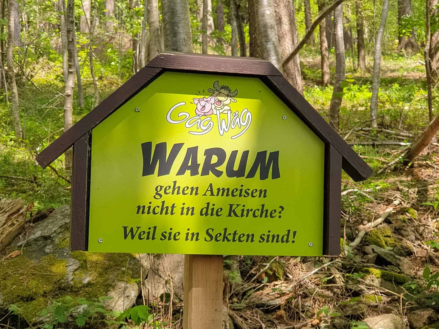
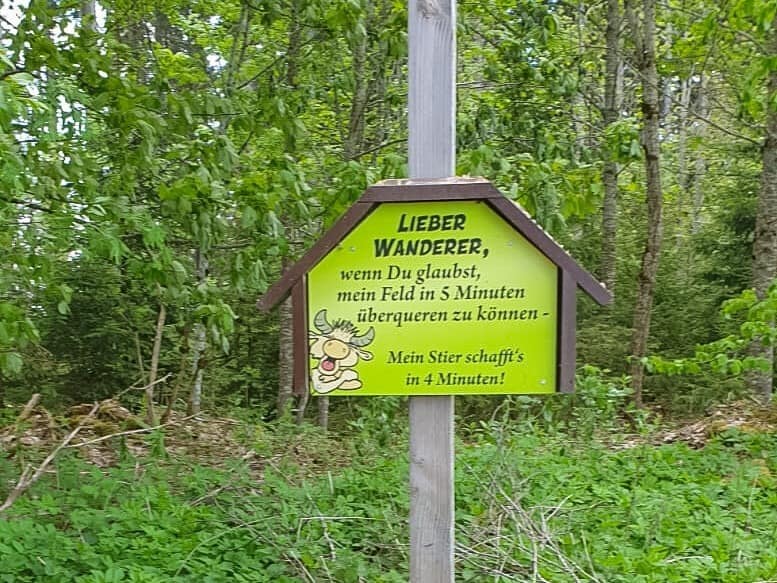
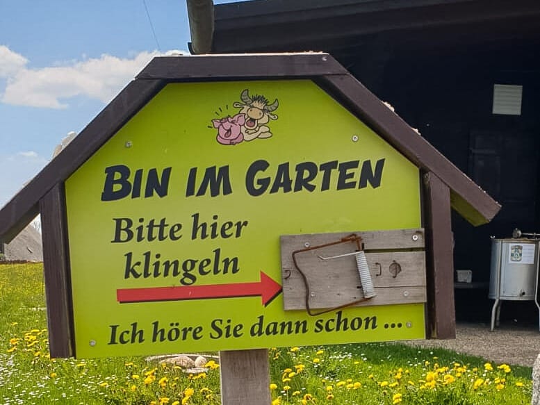
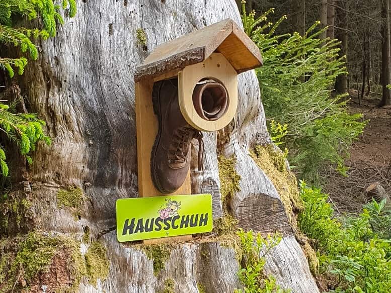
The Schwärzenbach rural youth has a very special one here Hiking trail for children created, the Gäg-Wäg.
What awaits you here?
The Gäg-Wäg takes you about 5 km through Schwärzenbach, the place has dense forests and picturesque valleys. In many places you have a fantastic view over the Upper Black Forest. If the weather is clear, you can even see as far as the Swiss Alps.
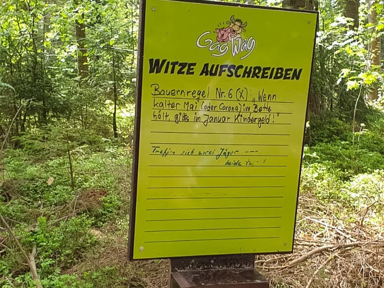
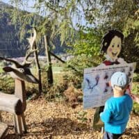
Every 250 to 300 meters, and this is where the rural youth comes into play, a joke station awaits you. This is how the name Gäg-Wäg came about, which means something like jokes way.
The rural youth designed these stations with great attention to detail. For example, some beer bottles are hanging from a chain on the tree and the sign next to it says "strong mushroom infestation".
Directly on the hiking route there is the Gasthaus Ahorn and the Cafe Feldbergblick to take care of your physical well-being. About 300 meters from the cafe, you can take a break to tread water. Two other inns are nearby.
Wich way do I have to go?
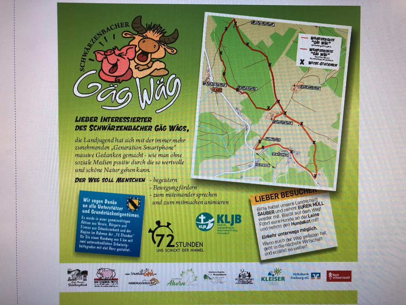
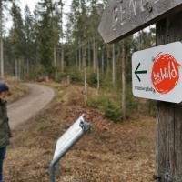
The start and finish point is the Platzberg barbecue and playground in Schwärzenbach. The Gäg-Wäg offers two routes or loops.
The right loop is about 2 km long and takes about 45 minutes. The paths are paved or paved and therefore suitable for prams. Eight Gäg stations await you here during the hike.
From the Platzberg it goes past the Cafe Feldbergblick through the village center to the Thomilishäusle. Then, turning left, there is a small ascent to the plateau. Continue on the Höhenweg to the Russenkreuz at the hiking car park. Orientate yourself to the left here again, and you will return to the starting point.
The other loop has the same course up to the Russenkreuz at the hiking car park. From there it goes straight ahead. The Förster-Dinger-Weg leads you past the ski hut, through the forest to the Hellewanderkapelle. Continue to the left and above the Haberjockelshof you leave the forest and continue walking to the left along the edge of the forest. From there you get back to the ski hut and on to the Russenkreuz. You can reach the barbecue area if you then keep to the right.
This route is about 5 km long and takes 1,5 to 2 hours. The paths are partly unpaved and therefore not suitable for prams. Here you can enjoy 20 joke stations.

How to get to Gäg-Wäg?
From the direction of Freiburg and Donaueschingen, take the B 31 direction Titisee-Neustadt and leave the street at the Neustadt-West exit. We continue on Neustädter Straße, the L 156 to Neustadt. Turn left onto Waldauer Straße K 4985 and continue towards Schwärzenbach.
From Lörrach From here, first take the B 317 in the direction of Donaueschingen, then the B 31 in the direction of Titisee-Neustadt and then continue as described above.
Further information
The best time for a hike on the Gäg-Wäg is between May and October.
Sturdy shoes are recommended.
The ascent is 117 meters and the descent is 89 meters. At 1112 meters you will reach the highest point of the route and the lowest point is at 1029 meters.
Start and finish are on a barbecue and playground. There are a variety of play facilities for children. The barbecue area has an open hut, a grill and various seating areas. It is advisable to reserve the barbecue area in the Titisee-Neustadt town hall in advance.


