
Brief overview:
- Length: 4,2 km
- Duration: ~ 2 hours
- Opening times: May to October (depending on the weather)
- Tour with interactive stations
- particularly suitable for families with children
An adventure for the whole family
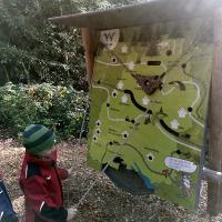
Are you looking for a special kind of hiking trail? Then let yourself be carried away into the world of water by the Unterkirnacher Rundweg. The hiking trail is not only nice to go for a walk, but also offers an informative insight into the water cycle and the associated effects. Children in particular get their money's worth here and learn something about the water in a playful way.
The circular route through
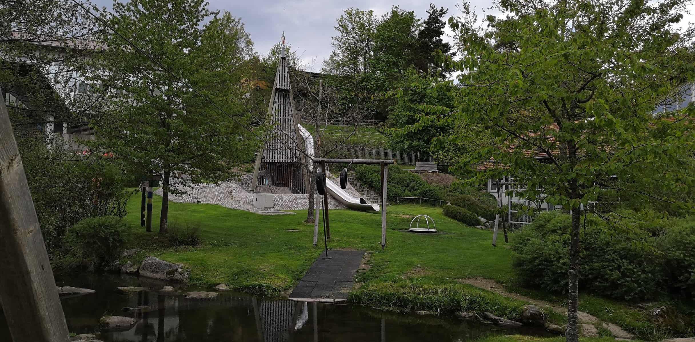
The hiking trail measures a total of 4,2 km. On average, visitors need around two hours to complete the circular route. The Unterkirnach hiking trail leads you past the play barn and the Aqualino. Then it goes to the orchards and a small forest area, which is characterized by small streams. During the walk through the Marbental, a great view of the Swabian Alp opens up.
Learn from water in a playful way for young and old
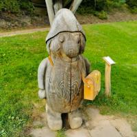
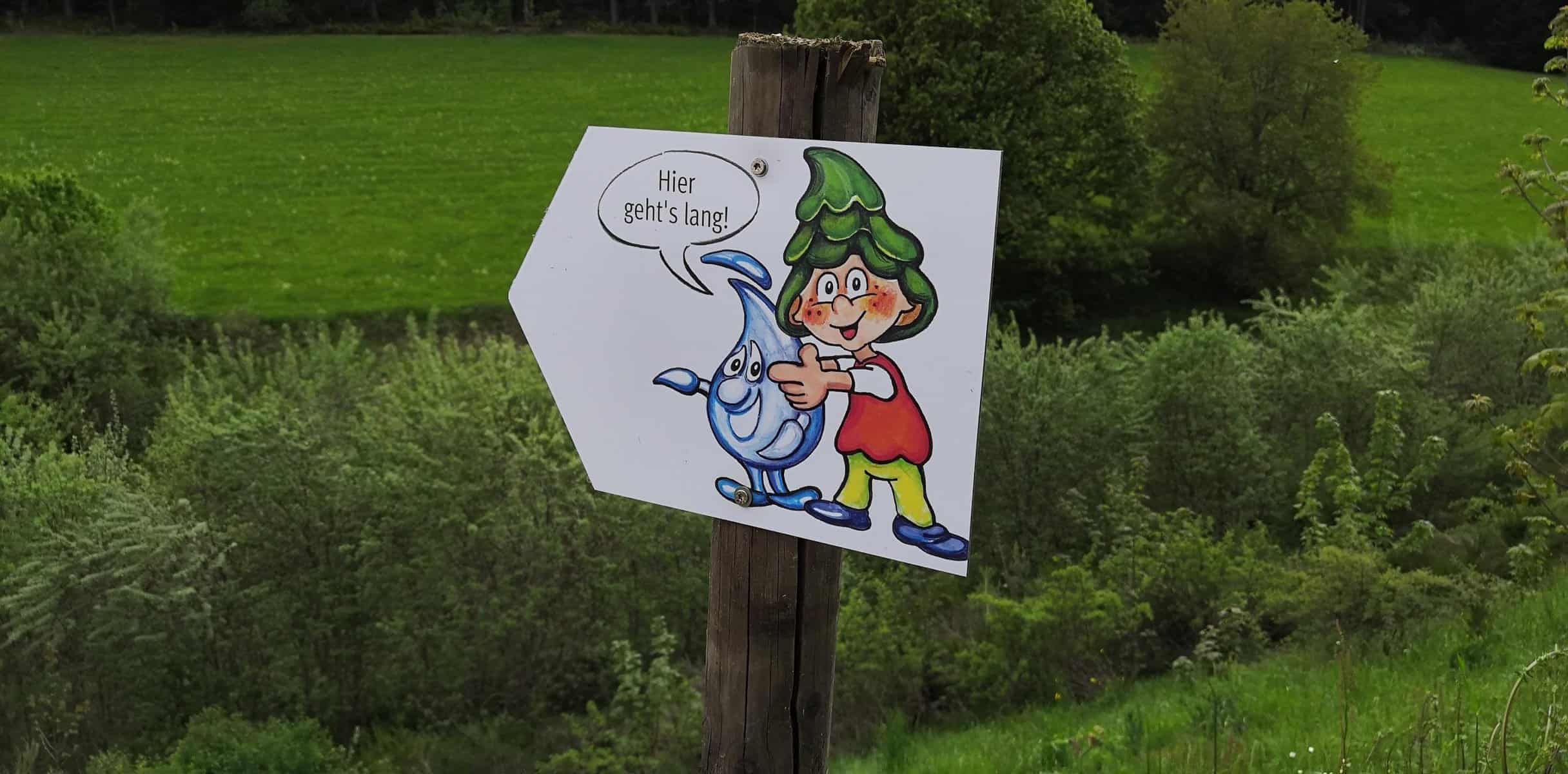
The hiking trail is particularly suitable for families. The troll mascots of the Unterkirnacher Rundweg are called Tanni and Quelline and appear again and again at various stations along the adventure trail. Tanni is a dwarf with a crown of fir trees and Quelline is a drop of water. At the various stations, they explain to children, using information boards and in a playful way, how the water gets from the springs to our homes. For example, you can use the "water speedometer" to determine the flow rate of the Arbach. Elsewhere, children can track the smallest creatures and organisms that consider water their habitat.
How well do you know about water as a habitat?
If you want to put your newly acquired knowledge to the test, you can print out the quiz about the adventure trail at the tourist information office or online and answer the questions from Tanni and Quelline. The tourist information also has the book and radio play "Tanni und Quelline auf dem Wasserweg" and a little surprise for children.
Tip
Since the circular route consists of many stations with water features, it is advisable for parents to bring a change of clothes for their children. If you haven't had enough of water after the adventure trail, you can make a detour to the local indoor swimming pool Aqualino after the tour.
Travel
Unterkirnach is close the town of Villingen-Schwenningen, from there the municipality of Unterkirnach is already signposted. Villingen-Schwenningen can be reached quickly via the A81 or A5. If you don't arrive by car, you can take the train to Villingen. From Villingen, bus line 61 goes to Unterkirnach to the “Kirnachbrücke” stop, from where the adventure trail is only a quarter of an hour away on foot.
Parking
If you come by car, it is best to leave it at the Unterkirnach sports field or at the Regentor.
Disability
The circular route was designed so that blind and visually impaired people can walk there without any problems. You can borrow an electronic scout at the tourist information office. Nevertheless, it is advisable to bring an accompanying person.


