The southern Black Forest is the highest area of the Black Forest with significant overforming by the Ice Age glaciers south of Freiburg-Donaueschingen. The actual term High Black Forest is accordingly not congruent. This also includes the highest area of the Middle Black Forest in the southeastern area of the Elz Valley.
The southern Black Forest is characterized by a centrally located high area from which most of the larger valleys radiate. The predominant peaks of the central area here are the Feldberg and Herzogenhorn. The plain of the Rhine towers conspicuously above the Rhine Schauinsland, Ballon and the blue one. That one on Mallorca a rental car Renting for a tour is normal for most. If you are familiar with the Arrived by plane or train you can also rent a rental car in the Black Forest and discover the beautiful mountains.
Feldberg

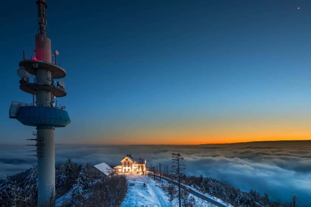
Aerial view of Feldberg with the television tower 
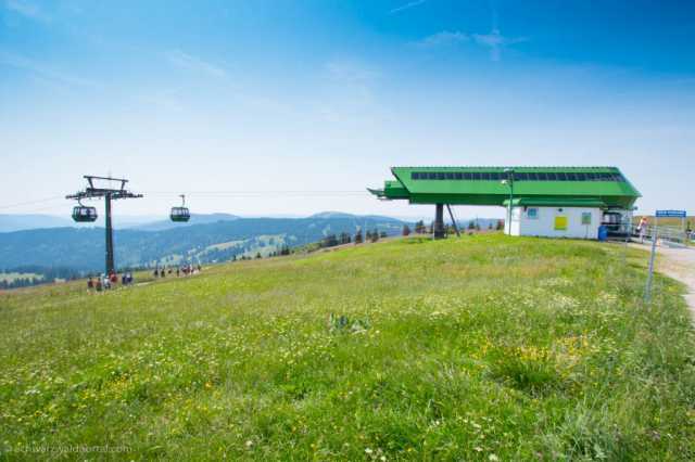
Feldbergbahn 
Todtnauer Hut at Feldberg -
Feldberg Black Forest
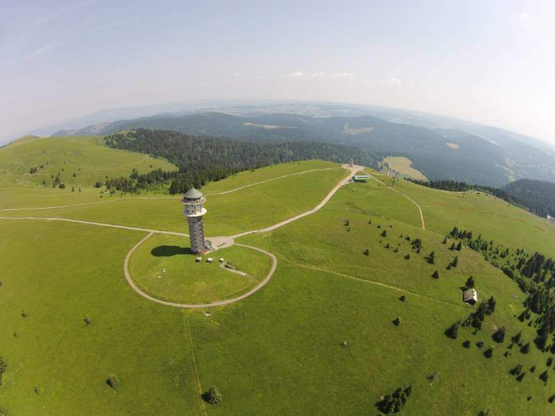

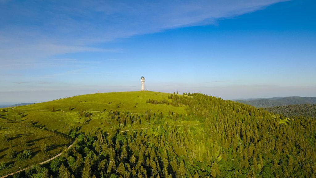
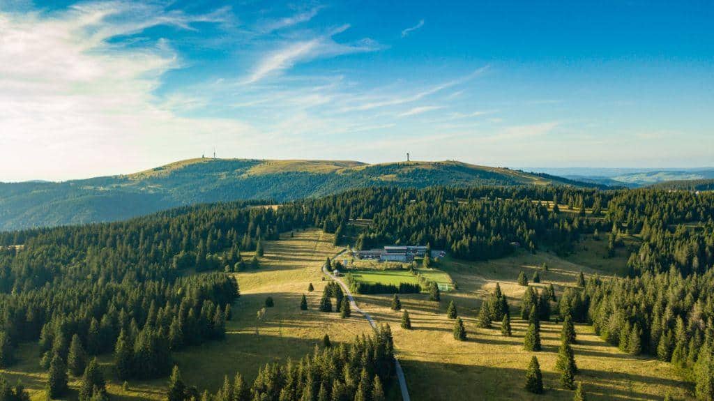
At 1493 meters, this mountain is the highest mountain in the state of Baden-Württemberg. It is also the highest elevation in the German low mountain ranges and is therefore the highest mountain in Germany outside the Alps. This mountain in the southern Black Forest also serves as the namesake of the community of the same name. The mountain is located southeast of Freiburg, in the area of the municipality of the same name in the district of Breisgau-Hochschwarzwald, surrounded by the municipalities Titisee, Hinterzarten, Menzenschwand and Bernau as well as the community Todtnau. About 2 kilometers southeast of this summit is the district of the same name at an altitude of 1277 meters.
The foot of the mountain can be reached by car via the B 317, which runs over the Feldberg Pass. The highest train station is a short distance away by train. Here the tourists get to the Feldberg-Bärental station and the Dreiseenbahn. There is a good bus connection from there. The current weather on the Feldberg can be seen on the webcam page.
Herzogenhorn

Herzogenhorn summit -
View from the Herzogenhorn to the Feldberg 
View to the Herzogenhorn


This mountain is the second highest at 1.415 meters Mountain in the Black Forest. Tourists who want to hike from Bernau to the mountain should best start at the hiking car park in Hof. It takes around 1,5 hours to cover the three kilometers and around 500 meters in altitude. Here it goes steeply uphill through pasture fields and mixed mountain forests. Holidaymakers reach the summit cross over the meadow and wide ridge of the Horn. The large orientation board shows which Alpine and Black Forest peaks can be seen here. The Kriegsbach, the Krunkelbach and the Prägbach arise from the Horn, which flows directly into the meadow. There is a large network of hiking trails on the Horn. This mountain is mostly climbed by holidaymakers from Menzenschwand, from Bernau or from the Feldberg Pass via the Grafenmatt. The mountain ranges from Beg south to St. Blasien and west are also popular hiking trails.
Ballon

Alpine view from Belchenhaus -
Sunset at the Belchen -
Summit cross on the Belchen summit -
Cows at the Belchen


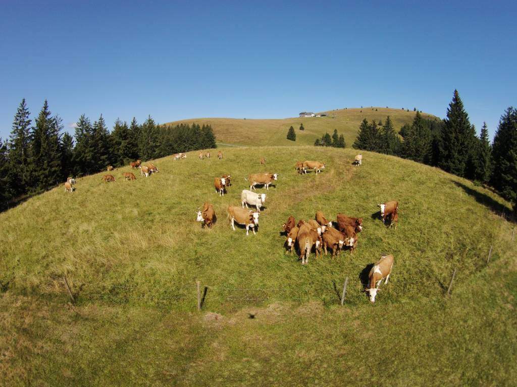
With its height of 1414 meters, the mountain is the fourth largest elevation in the southern Black Forest after Seebuck. On the top of the mountain, the respective territorial boundaries of the municipalities of Schönenberg meet, Munster Valley and Kleines Wiesental. Both Belchen webcams we show the current weather.
The mountain has a striking, symmetrical profile viewed from the Upper Rhine Plain with its characteristic, treeless hilltop. The name, which translates as the radiant one, is borne by other mountains in the adjacent low mountain range. Below are two mountains that are particularly noticeable when there is snow. Together with the Black Forest Mountain, these form the Belchen triangle. The small and large mountains of the same name are also within sight in Alsace in the Vosges. Grand or Petit Ballon, which, together with the aforementioned mountain, belong to the mountain system, can also be observed in the vicinity.
The panorama of this summit covers large areas of the Black Forest up to Hornisgrind, the Jura, the Vosges and also the Alps from the Zugspitze to Mont Blanc. In addition, the mountain allows wide views down into the plain of the Upper Rhine as far as Alsace.
Schauinsland
-
View of Hofsgrund from the Schauinsland -
Eugen-Keidel Tower -
Schauinsland near Freiburg -
Eugen-Keidel Tower 
Cows at the Schauinsland


The mountain rightly bears the name. From the observation tower on the summit there are very beautiful views in all directions, over the surrounding Black Forest mountains and valleys, over the Rhine valley down to the Vosges and the Swiss Alps.
The summit is best with that Schauinslandbahn reachable. The longest cable car in Germany can be found here. The associated valley station is located directly in Horben. It is well marked from Freiburg. You can also drive to the summit by car.
Detailed information can be found on our page for Schauinsland.
Blues

Panoramic mountain High blues in the southern Black Forest
The Blauen is the highest peak in the Markgräflerland. With its height of 1165 meters and the observation tower, it is one of the highest mountains in the southern Black Forest.
The view over wooded slopes, the Upper Rhine Plain, the southern Black Forest and the Swiss Alps is magnificent. Grandiose expanses are combined here with a view of three countries with authoritarian calm. Walks and hikes on a good network of trails with a healthy low mountain range ensure good relaxation. The well-known Berghotel Hochblauen is also located in this location.
Hare horn
-
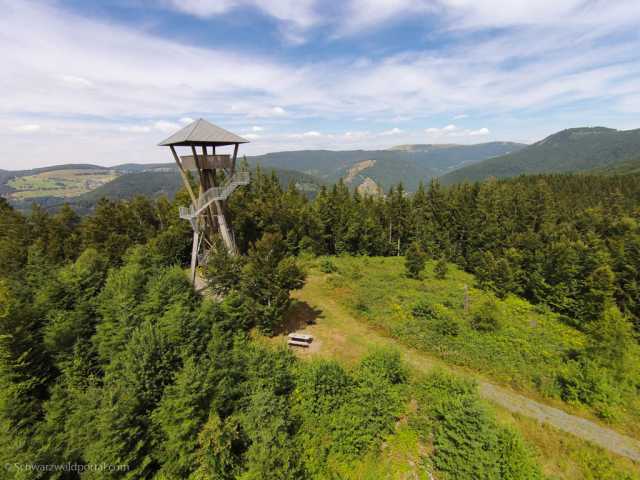
Todtnauer Hasenhorn Tower 
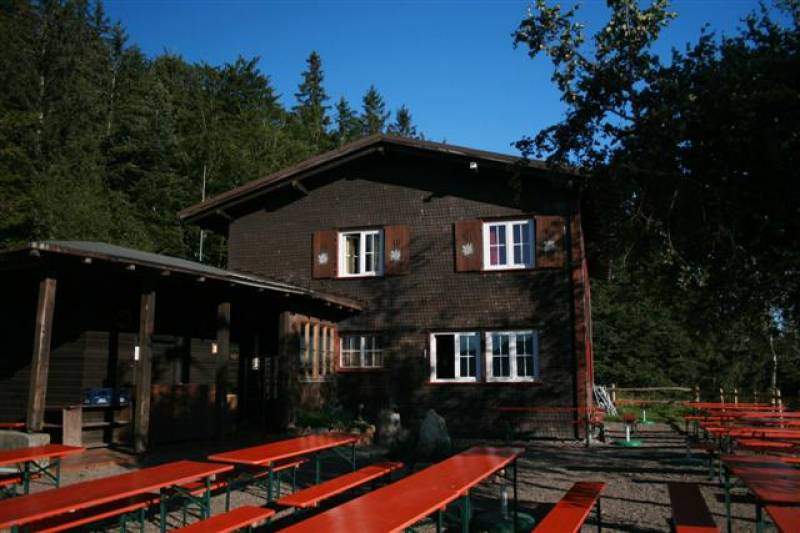
Mountain inn Hasenhorn near Todtnau -
Hasenhorn Toboggan Run Todtnau
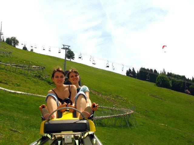
The Hasenhorn is a 1155,6 meter high mountain in the southern Black Forest. It is located near the municipality of Todtnau in the Baden-Württemberg district Lörrach. One hangs on the Hasenhorn Gasthaus Webcam with a view of Todtnau.
On this mountain there is the Hasenhornbahn, the Hasenhorn Coaster summer toboggan run, the Bikepark Todtnau, the Rabbit horn tower and the mountain inn of the same name.
The horn lies in the Southern Black Forest Nature Park southeast of the city of Todtnau and east of the district of Schlechtnau. Geschwend is located near the south-west of Elsberg. The meadow flows to the west and north through Schlechtnau and Todtnau and the tributary Gisibodenbach to the south-east through Geschwend.