
The popular circular hiking trail offers its visitors an insight into the world of the high moor area and its unique flora and fauna. The Hornisgrind At almost 1.170 meters in altitude, it offers breathtaking views over the Rhine Valley, the Vosges and, on particularly clear days, even as far as the Alps. The highlights of the adventure trail are undoubtedly the two observation towers and the Dreifürstenstein. The Dreifürstenstein symbolizes the border between the prince-bishopric Strasburg, the Margraviate of Baden and the Duchy of Württemberg. But how difficult is the tour? Where are parking spaces located? And how exactly does the path go? All important details about the Grindenpfad on the Hornisgrinde are summarized here in the article.
Length and difficulty of the trail
The highest mountain in the Central Black Forest can be reached via the Grindenpfad. The hiking trail is categorized as easy and can therefore be easily mastered by older people and children. The length of the route is approx. 4,5 km and at a relaxed walking pace it takes an average of 1 hour 20 minutes. The adventure trail begins at an altitude of 1.036 m above sea level and ends at 1.164 m above sea level. This means that around 150 meters of altitude are covered during the hike. Depending on the weather conditions, the adventure trail can be accessed without any problems from May to October.
Starting point - where can you park?

The easiest way is the grinding path Seebach / Mummelsee. For example, you can park at or near the mountain hotel. To get to the hiking trail, a road runs to the left of the mountain hotel, which after a few hundred meters leads directly to the first signs of the hiking trail .
Directions
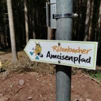
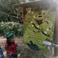
If you follow the road to the left of the Berghotel, you will soon come to the hiking trail. As soon as the first signposts are reached, it is child's play to stay on the path. The Grindenpfad runs on the Bohlenweg, past moorland, heather, the Bismarkturm and the restored Hornisgrinde observation tower. For that extra portion of fun, the hiking trail is divided into 12 discovery stations. At the individual stations, visitors of all ages can learn some background information about nature, the moor landscape, the habitats of animals and plants and also the climate of the Grinden.


